Environment Canada has issued a special weather statement for Ottawa with freezing rain expected to move into the area starting tonight.
The statement issued on Monday morning says a low-pressure system could bring freezing rain with temperatures expected to hover around 0 C overnight and into Tuesday morning.
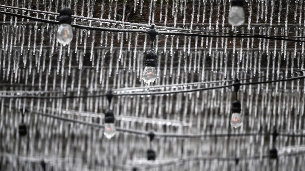
“As a result, ice accretion on the ground and road surfaces is expected to be variable as the ground is still relatively warm,” the forecaster said.
“However, icy conditions are possible, especially on elevated surfaces like bridges, overpasses and untreated roadways.”
Surfaces such as highways, roads, walkways and parking lots may become slippery.
The Algonquin Provincial Park area could also receive between five and 10 cm of snow locally by Tuesday.
Ottawa may see its first snowfall of the season on Tuesday with a 40 per cent chance of flurries in the evening. Low of minus 4 C.
Daytime conditions on Tuesday will be rainy and cloudy with a 30 per cent chance of showers. High of 6 C.
Wednesday will be cloudy with a 30 per cent chance of flurries and a 40 per cent chance of snow overnight.
The long-range forecast shows snow is possible the rest of the week and through the weekend.
Ottawa’s first snow last year fell on Oct. 30 when 0.2 cm of snow was recorded.